- Realistic 3D maps accessible to all citizens starting January 2026 -
- Innovative mapping service enhancing administrative efficiency, smart city competitiveness, and citizen convenience –
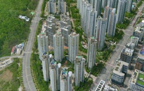
Incheon Metropolitan City (Mayor Yoo Jeong-bok) announced it will launch a nationwide first drone-based 3D map service in January 2026 to provide citizens with enhanced access to urban information and improved daily convenience.
This project aims to elevate map service quality by conducting 3cm-grade high-resolution drone photography across most urban areas (excluding no-fly zones like the Five West Sea Islands, northern Ganghwa, and airport control zones), completing a realistic 3D model covering all 687 km² of Incheon.
The constructed 3D map will be integrated into Incheon City's geographic information system upon project completion this November. Starting January 2026, it will operate as a public service accessible via the city's internal administrative network and directly by citizens. Selected demonstration videos and pilot results have already been showcased at exhibitions and Citizen's Day promotional booths, receiving evaluations that its quality rivals top-tier private mapping services like Google and Naver.
Lee Cheol, Director of the City Planning Bureau, stated, “This project will dramatically enhance the service quality of Incheon's spatial information platform, maximizing administrative efficiency and further strengthening our smart city competitiveness.” He added, “Above all, by providing high-quality 3D map services that citizens can directly experience, public 3D maps will play a core role across diverse fields such as urban planning, disaster safety, tourism, and real estate.”