- Launching a Drone-Based Realistic 3D Map That Gives Residents Access to Immersive City Information -
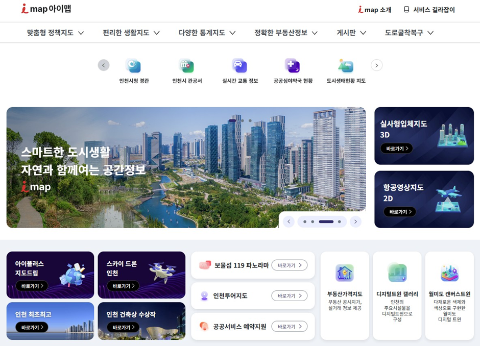
Incheon Metropolitan City (Mayor Yoo Jeong-bok) announced that, starting on March 23, Incheon’s flagship map portal “i Map” will begin offering a 3D map service, helping residents understand urban spaces more intuitively and providing easier access to a wide range of information for everyday life.
Built from drone footage, the service uses a realistic 3D map that presents terrain and building exteriors in a form that closely reflects actual landscapes of Incheon. Moving beyond a flat map format, the new service presents buildings and terrain in three dimensions, giving residents a more vivid view of urban space.
A 3D model based on real images precisely recreates terrain and building facades. Compared with the simple blocks used in earlier models, the new version presents a far more lifelike view of the city. Residents will be able to examine Incheon’s urban spaces from multiple angles, while gaining a more intuitive understanding of the city’s structure and how it is changing.
Launched on March 25, 2021, i Map began as the Incheon Real Estate Plaza, bringing together aerial photographs, satellite imagery, land registers, cadastral maps, zoning information, development plans, and other real estate data in one place.
The new i Map will provide about thirty 3D policy maps with the existing 2D maps, covering a wide range of topics closely tied to daily life.
Examples include “i+ MapDream,” which helps users check Incheon’s childcare policies, facilities, useful venues on a single map, “Incheon’s Firsts and Oldests,” which introduces the city’s earliest and highest achievements, “Incheon Architecture Awards,” which highlights outstanding buildings, “Sky Drone Incheon,” which lets users view major attractions and cityscapes through drone footage, and “Incheon Tour Map,” which introduces various ways to explore the city through the Incheon Tour website.
Through the new 3D map service, Incheon plans to expand the use of spatial information across administrative areas such as urban planning, childcare, and tourism, while broadening access to map services built around residents’ daily lives. Incheon also plans to continue advancing the service through a range of policy maps, making spatial information easier and more convenient for residents to use.
Lee Won-ju, Director of the Urban Planning Bureau, stated, “The 3D i Map service marks the next step beyond a flat map-centered platform, opening a more immersive spatial information service. Incheon will continue to expand spatial information services and policy maps, helping residents understand and use the city more easily and conveniently.”