- New “Urban Change Timeline” service enables users to compare changes in Incheon over time in an immersive 3D environment -
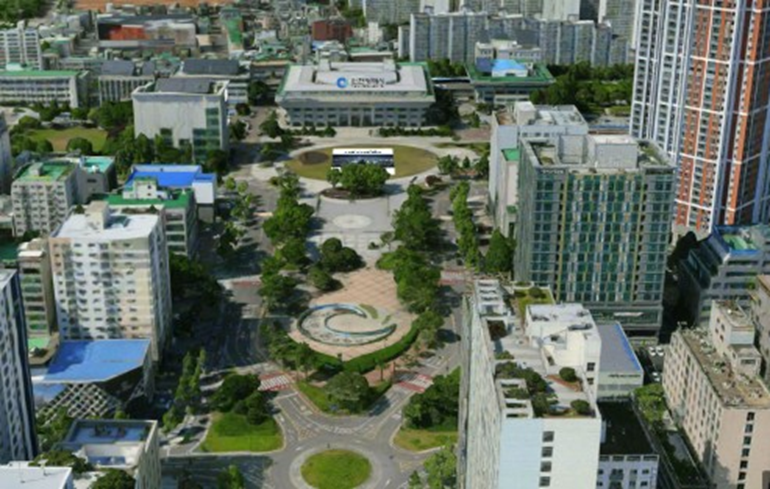
The Incheon Metropolitan City (Mayor Park Chan-dae) announced that it is launching next-generation science-based administrative services by utilizing an ultra-high-resolution immersive three-dimensional (3D) map built with cutting-edge drone technology.
The city announced that it is rolling out its Immersive 3D Map Service, which is based on high-capacity 3D spatial data captured through precision drone surveys. It is also developing a new Urban Change Timeline service that allows users to compare the city’s appearance across different years in a three-dimensional environment.
The immersive 3D map provides a highly realistic virtual representation of the entire city of Incheon. After completing 3D spatial data for all 687 square kilometers of Incheon in 2025, the city is updating the system in 2026 by conducting focused aerial surveys of 134 square kilometers covering areas that have undergone significant urban development.
In particular, the newly introduced Urban Change Timeline feature represents a next-generation urban management model, enabling users to compare and analyze changes in Incheon’s urban landscape over time in an immersive 3D environment. By systematically accumulating and integrating annual 3D spatial data, the city expects to significantly improve administrative efficiency by enabling precise virtual analysis without the need for on-site visits. The system can support a wide range of administrative functions, including visual openness analysis, landscape review, disaster preparedness and response, and environmental monitoring.
In addition to supporting administrative operations, Incheon will expand access to these high-quality 3D maps through a citizen-oriented 3D policy map service. By accessing imap Incheon (https://imap.incheon.go.kr), citizens will be able to explore major urban landmarks, key districts, three-dimensional terrain and building information, and everyday public service information in a highly realistic virtual environment.
Meanwhile, to ensure stable public access to these ultra-high-resolution immersive 3D maps, the city proactively upgraded the technical foundation of its spatial information platform (imap) last year by completely replacing its core engine with domestically developed software and enhancing overall system performance.
Seo Jeong-ha, Head of the Incheon Land Information Division, stated, “The development of our ultra-high-resolution immersive 3D maps and Urban Change Timeline service has further strengthened the foundation of Incheon’s digital twin platform. We will continue to update our precise 3D spatial information while expanding public services and collaboration with the private sector to enhance the value of Incheon as a future-ready 3D city.”
